Tuesday, March 26, 2013

Borax, Boron, Borates, and a HUGE pit

Today we left Mojave at 8:00 and headed out to the U.S. Borax Boron mine, about a 40 minute drive. After the lithium evaporation pools and the wells used at Searle's Valley, this mine was very different. It consisted of an enormous pit, 1 mile by 1/2 mile in area, 500 feet in depth, that has been mined for the last 100 years and yields 40% of the world's supply of borates, which are used in countless products including soaps, glass, neutralizers and ceramics.


Needless to say this was an enormous operation, and it took a while to comprehend the scope of it all. We started in the visitor center, where we walked around their exhibits on the history, general procedure, and market of the mine, and then we watched a short safety training video. When the video ended, we grabbed our complementary hard hats and very attractive safety glasses and excitedly boarded the tour bus.
We were accompanied by two of the mine's geoengineers, who explained various features of the mine as we passed them, and answered our questions about their plans for the future and the geology of the area. Luckily, they happened to be blasting a section of rock at the side of the pit while we were touring, so the geoengineers led us up to a good vantage point and we got to watch from a safe distance as a ripple of explosives freed up tons of minerals. Below you can see us all trying to catch the blast on video.

After that thrilling and unexpected tangent, we went down into the pit and got to do some of our own prospecting, picking through piles of sparkling minerals such as ulexite, kernite and borax. It was amazing to see such unique-looking gems just lying in piles all over the ground, and our group spent about an hour selecting the most interesting cuts.

It sounds strange, but I had trouble keeping myself from taking more than 3 of each type, as each sample was more beautiful than the last. We did have to employ some self control due to airlines' baggage weight limits, but in the end everyone was very satisfied with what they took away. Below is one of the better chunks of kernite I brought back.
After everyone had had their fill of fancy rocks, we drove back up to the visitors center (passing the processing plant on the way, which sadly we could not take pictures of but which was nevertheless very cool) and ate lunch in the parking lot, enjoying the warm sun and a light desert breeze. Then it was back in the vans and off to Temecula.
We had some interesting transportation struggles along the way, as keeping a series of 4 large white vans together gets more difficult as traffic increases (Temecula is much more populated than our previous destinations). However, after a few U-turns and confused cell phone conversations, we reached a restaurant called Wahoo, where we ate dinner (burritos and tacos). Back at the hotel a bunch of us took advantage of the hotel's jacuzzi and swapped stories of the day.
It was a very exciting day and I will definitely sleep well tonight. Tomorrow is supposed to be one of the dirtier days, so I'm putting out my boots, jeans and a disposable t-shirt before I go to bed.
Thanks for reading!

Monday, March 25, 2013

"Now stand on that rock and teach everyone."


This morning, we drove into the town of Trona, CA to the Searles Valley Minerals mining and refinement facilities.  Soda ash which is sodium carbonate, borax, and potash are mined from the vast supplies at this plant.  By vast, I mean that some of the materials could continue to be mined for 1,800 years at the current rate! The upper salt, which is the top layer that contains the minerals, is about 80 feet deep.  A man by the name of Jim  Fairchild who had worked at the mine for 50 years gave us a presentation and a driving tour.  The Searle Valley is pretty much the only home in the world to hanksite, a six sided crystal that is of the composition Na22K(SO4)9(CO3)2Cl   We stopped and were able to collect large hanksite crystals in addition to many halite as well.  Here is a picture of a few hanksite crystals:


We were also able to view the processing plant.  The company is very strong on recycling energy and waste.  They reuse heat, process carbon dioxide from burning fossil fuels, and return brine back to the lake.  Here is a picture of the percolation pond with the mountains in the distance:


And here is a picture of the halite where the water level has actually reached the surface of the lake:


After lunch, we headed about 6 bumpy miles to the Trona Pinnacles of Searles Lake.  On our drive, Sam Bowring, a top geology professor at MIT, started quizzing me about how the pinnacles were formed.  After much reference to our terrascope-provided guidebooks, I provided many answers. Upon our arrival, he told me to go stand on a rock and tell everyone else what I had learned! Instead of our usual lecture from Sam, I was telling people that the pinnacles were made of tufa, which is a deposit of 
calcium carbonate and organic material.  The algae in the lake lowered the carbon dioxide concentration in the water, which would have precipitated the calcium carbonate.  The pinacles formed for a similar reason that coral builds in the ocean based on varying sea levels.  Many movies on Mars were filmed at this site.  On the site, it was interesting to view a google earth image of the pinnacles to hypothesize about how and why they were laid down.  The geologists guessed that they were on top of old fault lines where geothermal springs had popped up because each set was fairly linear.  Learning and studying about the earth seems so fascinating out here with all the rare examples of geology right in front of yours eyes! Here are a few pictures of the pinnacles.  See the people in the photos for comparative size.


Finally, on our drive to our hotel in the Mojave Desert, we saw a huge wind farm.  This was particularly cool for me because I learned about wind power a few weeks ago in 1.007, Engineering for Environment and Sustainability and had visited a wind turbine blade testing facility.  See literally hundreds of wind turbines in real life was amazing (although this word has lost meaning).  Here is a picture from inside the car, although this is only a piece of the entire wind farm,


Sunday, March 24, 2013

DEATH VALLEY!!!!


I woke up around 7, took a quick shower and met my fellow adventurers at the breakfast buffet of the resort where we were staying in the middle of Death Valley. Some of the group had gotten up early and gone romping around in the desert as the sun rose over the mountains, but unfortunately I could not be stirred at 6:15. We ate quickly, packed up our possessions (we are quickly becoming skilled in the nomadic art of sleeping every night in a different place and packing up without a trace the next day) and headed to the all-too-familiar vans. Throughout the day we visited a lot of incredible geological locations. Most have already been very accurately described by Rin, so I'll try to give a different spin on today by listing all of the songs that popped into my head, accompanied by the mind-blowing view that inspired it:


...that one inspired Home on the Range (which I hummed to myself for approximately 30 minutes)


...doesn't this remind you of That one song from Lord of the Rings?

Okay, last one:

... understandably brought Free Fallin to mind.

When my head wasn't filled song, I was busy asking "Is that an alluvial fan? ...how about that one?" and seeking out shade where I could. Anna Walsh knows how to appreciate a good shade:

We all discovered the tragic paradox of Death Valley hydration: needing to drink a lot of water does not mean bathrooms are abundant, unfortunately. However, new challenges mean new adventures!

And now to conclude this rambling post with a double-haiku from Kathryn Buggs, featuring the wonders of Death Valley:

"Valley of Death, yet
so much movement before me
land alive, speaking.

Scrub gives way to fields
rhythmically passing, I wonder
what would Steinbeck do?"

We can't wait to see what tomorrow has in store! Good night!


Death, Life, Rocks and Valleys

Today we visited Death Valley!


It was my first time there, and definitely the more interesting for having geologists along to tell stories about the rocks nearby. Dwight, Sam, LeAnn, Erin and Annie were surrounded at each of our stops by people curious to hear more about the valley.


In terms of statistics, the Valley describes itself in terms of superlatives: hottest, driest, lowest.


  • It was here that the hottest temperature on record was recorded: 134 F (56.7 C).
  • A desert is defined by having a higher rate of evaporation than precipitation. Death Valley has an annual precipitation rate of 2.36 in (60 mm) and an annual evaporation rate of 128 in (3.25 m).
  • The Valley floor, located in a basin between two ridges (part of the basin-ridge system common throughout Nevada) is 282 ft (86 m) below sea level - the lowest point in North America.
However, I was surprised to find, the valley also has a nearby peak of 11,000 ft, as well as supporting way more life than its name implies. Everything from bristlecone pines to kit foxes lives in or around the valley, perfectly adapted to survive in the climate that drains humans dry (heh).


We visited, in order, Zabriskie Point, Ubehebe crater, Mosaic Canyon, Father Crowley's Overlook, and Fossil Falls. We also passed Owen's Lake, sadly dried up due to water diversion to LA.


Zabriskie Point looked like this: 
Not pictured, an alluvial fan was located behind the rocks, where runoff during the Valley's flashfloods (it doesn't rain often but when it rains it pours) would roar out to base level - the lowest point in the Valley.


Here's the Ubehebe crater (NOT shown to scale):

We walked around the perimeter and I ran down to the bottom with Annie and Erin, our TA's from the fall. Sadly, I am unfit and the walk up was not nearly as much fun. 


Bottom from top:


 Top from bottom (if you look really closely, the tiny dots around the rim are people walking):


Here's another picture to try and give you a sense of scale. I think the West is just too big to fit in my camera (which is awesome).


Next was Mosaic Canyon, or the photogenic canyon.

The walls are actually calcium carbonate (CaCO3) folded on themselves due to heat and pressure softening them, and faults folding them. But water draining from higher up, cut a path through the rocks, polishing it and making it easy to inspect the layers. Several crowded round Dwight, Sam, LeAnn, Annie and Erin for story time.

Here's Erin explaining how folding works. She'll probably kill me for posting this :).


After a quick water break we drove up a long winding spectacularly beautiful highway. Unfortunately I slept through it all, so I no pictures to show you. But I woke up in time to see the view of Panamint Valley once we reached the top, which was spectacular. Here's Emily at Father Crowley's Overlook :)


Finally we started leaving the valley regions. We finished our leaving about an hour later (Death Valley is the US's largest national park, and longs to keep you there - til you die) but on the way out passed by two more things. Owen's Lake was a big basin filled with a puddle about 1 foot deep and some yellow grass. 10,000 ago, it was a beautiful lake, and even as soon as 50 years ago, paddle boats transported silver ore from the east to west side, while orchards with cherries, apples, pears and the like grew on the banks. However, LA diverted the water from the stream feeding the lake, and left it with only enough to prevent the basin from drying out and blowing dust everywhere. (On the other hand, perhaps due to draining of the basin, the land was saved from development by outsiders.) One cool thing about the diverted water - LA managed to set up a system such that the water traveled due to gravity and had no need to be pumped over the mountains. I'm hoping someone back at MIT can build me something like this.


Last but not least we saw Fossil Falls. There were no fossils (misleadingly) but there was plenty of cool rocks to admire, polished as there were by waterfalls originating from water in Owen's Valley. The water was no longer there, but the rocks remained for us to pretend burrow in, through and around (see, Holly in a hole!).


Now we're at another awesome hotel in Ridgecrest (the rooms here are so big there are ECHOES) and we're looking to have another awesome day tomorrow!

Til then, big beautiful west.


-Rin

Lithium mines, volcanoes, and Death Valley... oh my!


I’m not as adept at accessing Wifi as my blogging compatriots, so although this may seem a bit redundant, I’m now posting my experiences from yesterday that I wrote in the van on the ride to Death Valley:
After 18 hours of travel yesterday, we woke up in a Best Western in Tonopah, Nevada this morning feeling refreshed and renewed. We were on the road by 8 am (8:03 to be precise) after grabbing a complementary breakfast (I indulged my morning appetite with a good helping of biscuits and gravy). I was stunned by the stark beauty of the mountainous desert landscape which had been too dark to appreciate the night before, except for a black outline of crooked rock against the navy blue sky. A wide flat expanse of sand, grayish brush, and an occasional, lonely tree extended away from the 2 lane road on which we were driving, giving way a few miles out to the roots of bare mountains and plateaus. 
Our parade of 4 white vans and Erin’s minivan was the only sign of civilization to be seen in any direction for the majority of our 2 hour trek. We were heading for the Rockwood lithium mine, the only site of lithium production in the United States. Most of us Terrascopers had read about this mine the night before in the booklet given to us with background information on all the locations we’re visiting, so we had some knowledge of how their mining process worked. Brine is pumped out of the earth from aquifers and brought the surface, where the solution becomes more and more concentrated as it is moved through series of evaporation pools, until salts have precipitated, undesired elements are removed and they are left with three sellable forms of lithium: LiCO3, LiCl, and LiOH. 

Though we had an idea of what to expect in terms of the mechanics of the mine, nothing could have prepared us for the scale. Massive evaporation bonds as large as a mile long spread out before us, each one more dazzlingly turquoise in color as salt concentrations increased. Our tour guide, Melissa, showed us how to perform water tests to monitor the state of the brine being pumped up from the earth, and also took us to the top of a huge mound of stockpiled sodium chloride (also known as halite, basically table salt, a byproduct of the lithium mining method) where we proceeded to taste-test the ground beneath our feet. It was quite savory. 
After that, it was back in the vans and off to a cinder-cone volcano we had spotted in the distance. We stood at the foot and marveled as Sam explained to us the geological origins of such a phenomenon (an explosive blast resulting from the interaction of magma and underground water tables)… and then we got to climb it! 
I was glad to be wearing hiking boots by the time we got to the top, as shifting and crumbling volcanic rock is not a great climbing surface while lacking ankle support. We took a few minutes to absorb the stellar view and then commenced our descent. At the bottom, we were feeling so victorious that a human pyramid spontaneously assembled before we got back in the vans. We visited a couple more geologic formations and then buckled up for the drive to Death Valley, which is where we’re heading now as I type. Apparently it’s going to be spectacular: it’s wildflower season and we’ll be driving in around sunset. Honestly, though, I’m having trouble imagining anything more beautiful than the stratified mountainsides zooming past us right now.
Everything in Nevada is so BIG. Wide empty desert, huge mountains and cloudless skies surround us, and I don’t believe I’m going to get used to their awe-inspiring majesty any time soon. But I’ll let you all know if I do.


Saturday, March 23, 2013

This trip rocks my world.

The drive to our hotel was too dark to see any scenery, so my first view of the landscape wasn't until the next morning, but it was totally worth the wait.  The T on the mountain symbolized Tonopah, NV the only town for many miles.  The mountains here are just breathtaking and the pictures definitely fail to capture the scale and distance you can see.  There is just nothing here except endless desert and brush surrounded by distant mountains.  

But all too soon (8:00 AM), we left Tonopah for our destination of the day, Clayton Valley, NV.  There, we toured the only lithium mine in America, operated by Rockwood Lithium.  The tour started off with an indoor presentation and was particularly special to me because of all the questions other people on the trip were asking.  It is such an amazing experience to be in the presence of so many smart and curious teenagers and adults.  After that, we drove around the lithium evaporation ponds. The lithium-enriched brine is pumped to these ponds from the aquifers under the earth in order to raise the concentration of the solution and precipitate out salt.  Below you can see the first evaporation pond we viewed.


LeeAnn Munk, a geologist from the University of Alaska who studies lithium, is traveling with us.  She visits the Clayton Valley mine every year to test samples of the water and study the lithium aquifers.  Below you can see her rinsing her pipette in order to ensure pure samples.  She told us to taste a drop of the water - quite salty because of all the NaCl.


Here is a dredger removing salt from building up in the evaporation ponds.  The lithium mine is only in production from April-October because otherwise it is too cold for the evaporation ponds to work.  At this time of year, a lot of maintenance was going on.  I thought this picture was cool because the colors were so pretty!


Here is some salty evaporated area. The pattern seen in the picture below was a common sight today.  Many people had fun licking the salt and stomping on the crystals - we even go to take some samples with us.


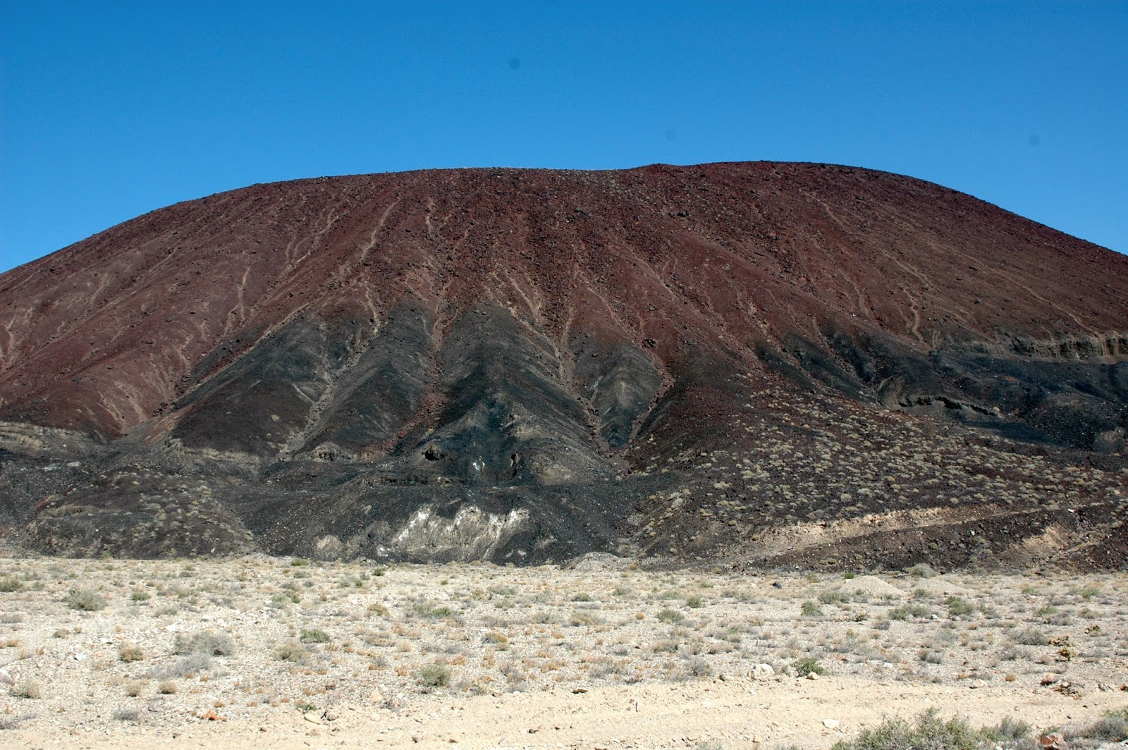
Finally, our tour of the lithium mine was finished but next we were off to hike a volcano!  At this time, Sam Bowring, a geology professor at MIT, Dwight Bradley, a USGS geologist, and LeeAnn Munk took over teaching us.  The rocks were so awesome!  It was quite fun to find unique rocks and inquire about what type of rock you had discovered.  The volcano was mostly made up of basalt rocks that had formed from a flash explosion a VERY long time ago.  These rocks were porous and therefore very light.  It was interesting to hear the geologists debate whether one side of the mountain was formed from a lava flowor erosion Here is the volcano:


Rin and I on top of the volcano:


And our caravan of cars in the background for some scale:


One thing to note is that it is so hard to comprehend the scale of everything you see!  This volcano looked pretty tiny from the lithium mine but was huge once we got there.  I can't wait to explore Death Valley tomorrow.  The view coming in over the pass from Nevada was not something I could have ever imagined or captured in a picture.


Home Sweet Nevada, Day 0

Mmm, Tonopah Nevada. We've finally gotten to the rooms after 18 hours of straight travel (and only one Chipotle burrito :( ).

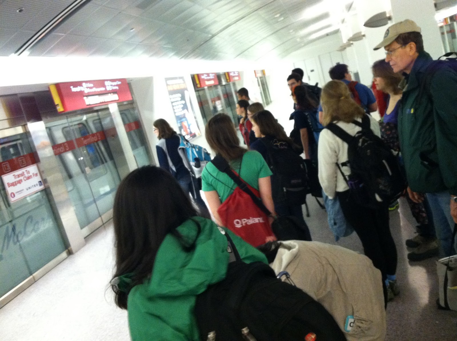
What we did all of today was practice waiting for each other in groups:


Waiting for trains:


Waiting for shuttles:


Waiting on shuttles:


Etc.
Also the Vegas airport has slot machines.


Anyway, jokes aside, we've finished our 4 hour drive north to Tonopah where we will stay for the night before heading to Clayton Valley to see lithium mines (and hike volcanoes) tomorrow woot.

Our fine establishment for the night:


It's actually been a pretty cool start to the trip, considering that we've only flown and driven. Everyone got a field guide with details about each of the stops we are making for the trip. We won't be staying in the same place two nights in a row, which is a little disconcerting to think about.
Right now I'm a little tired so I guess I'll wait til I've actually seen some mines to post more.
Til then (and hopefully my toes don't freeze off, its as cold as Boston at night)

-Rin

PS a haiku from K. Buggs

Night, desert so cold.
Why? Shiver! No idea
Where Tonopah is.